ohio Trails

The " Great American" Route Through Ohio

Several iconic trails play host to the Great American Rail-Trail in Ohio—the Ohio & Erie Canal Towpath Trail and the Ohio to Erie Trail.


The Ohio & Erie Canal Towpath Trail connects two major metropolitan areas and one of the country’s most-visited national parks—and comprises a major portion of the Cleveland-to-Pittsburgh corridor of the Industrial Heartland Trails Coalition, one of RTC’s TrailNation™ projects, which will connect Pennsylvania, Ohio, West Virginia and New York via a developing 1,500-miles-plus trail network.


In Clinton, the Great American route branches off on the Ohio to Erie Trail, which—connecting to Cincinnati through Columbus—is composed of many trails that link the state’s diverse communities, including that of the largest population of Amish in the country. Along the route, commemorative sites pay homage to the state’s rich historical attributes, including the role that it played with the Underground Railroad and as an innovator in American aviation.

335+
TOTAL MILES

232+
EXISTING
TRAIL MILES

25
EXISTING
TRAILS

69%
COMPLETE

Discover History on the Trail

Diplomatic Reception Rooms

In these 42 rooms, members of the U.S. Department of State meet with diplomats, entertain foreign leaders and engage in other activities of...

Trail: Great American Rail-Trail
State: DC
Architecture Politics, Policy & Justice
Duke Ellington's Birthplace

Edward Kennedy “Duke” Ellington was born in 1899 in a house that used to exist on this site. Today it’s a post office but a mural (by Aniekan Udofia)...

Trail: Rock Creek Park Trails
State: DC
Arts, Entertainment & Sports Black History
Godey Lime Kilns

To find these cool ruins from the 19th century, you’ll have to trek a bit off the beaten path—from the intersection of L Street Northwest and 26th...

Trail: Great American Rail-Trail
State: DC
Architecture Commerce, Economy & Work
See All History

Indiana Trail Reviews

avoid north trail

The north part of this trail is in a less than stellar part of town

Trail from West Columbus to London

I re-rode the Camp Chase Trail from its eastern terminus to Battelle Darby Creek Metro Park today, and rode the section from there west last year. It's a nice trail, in good condition, and the gaps have been filled in over the years. Of particular note is that the gap orangedoug mentioned, at the Metro Park, was closed in March of 2020. It is a bit difficult to find the connection through the park from the west though; go to the roundabout at the west end of the parking lot, and find the trail branching off southwest (which would likely be the last direction you would expect to find it), and that's the connector, with an Ohio to Erie trail marker hiding in the woods.

I rated the trail 4/5 instead of 5/5 because while it is in good condition, it's the least scenic of the "big 5" trails in Columbus. I ride the Alum Creek Trail and Olentangy Trail every year; they're beautiful. Comparing this trail to the Alum Creek, the major difference is you forget you are in a city on the Alum Creek Trail. On the Camp Chase, for the first 7 miles going west, it's almost all city (there is a park area near Wilson Road). It does open up and become more scenic past Georgesville Road. Realistically, the section east of there is a "every few years" trail for me.

Parts of the eastern section were also reminders of the increasing poverty in parts of west Columbus since the pandemic; tent encampments were set up along parts of the trail and the parallel railroad, which hadn't been present the last time I rode the trail in 2020. In the afternoon of one of the first warm days of the spring, it didn't feel dangerous, but if you're planning an Ohio to Erie trip and aren't from the area, plan to be Downtown before sunset. At least the trail seems to be of use to the residents living by it; several tents had bikes by them and one man was working on his bike from the tracks when I went by in both directions.

The Hilltop Connector to the Scioto Trail at the eastern end is not a bad connector at all. Road speeds are moderate, most of it has a dedicated bike lane, and even at rush hour it didn't feel risky (and I'm not someone who rides roads).

Conotton Creek Trail

Nice, paved trail. Great scenery and remote location make for a wonderful summer evening ride. Looking forward to going back this fall.

Day 5

Another one of the five great trails out of Xenia. This is a good one to close out a week of riding. Thank you, Xenia!

Accordion

September 2022

Used this connector trail as we finished up on Heart of Ohio Trail and continued on seamlessly to Kokosing Gap. This connector now goes under S. Main Street Bridge.

Downtown Connector

We rode this trail on October 23, 2022. It is best to take this trail on a Sunday when there is not a lot of traffic. The trail along Jack Gibbs is in need of repair. Also the weeds and brush need attention by the city of Columbus.

Beautiful trail

This is a nice trail through the trees, especially in the Fall when the leaves were turning yellow. The road crossings in the southern portion weren't bad when using the signals. The trail surface was in good shape.

My Compliments bill.beue

How about a round of applause for the cities, counties, employees, and volunteers who put this great trail together. Unlike the LMRT, this trail is not a state park but a series of parks in many jurisdictions. I do not know who coordinates this effort to create the ‘whole’, but good job.

Beautiful trail with lots of different views, wooded to open farmland. Creeks and hills, with alot of fall foliage. We'll maintained, nice trailheads, with restrooms and picnic tables and benches.

Beautiful trail with lots of different views, wooded to open farmland. Creeks and hills, with alot of fall foliage. We'll maintained, nice trailheads, with restrooms and picnic tables and benches.

Marshallville to Warwick Rd

The Heartland trail's pavement currently ends in Marshallville. However, the park district keeps the next 4 miles mowed. You have to go off trail on worn paths to get around gates that are installed to keep vehicles off the trail. The park district plans to have this 4 mile section paved in 2026. It was fun to ride this section. Of course this requires a bike that is able to ride on grass/gravel.

Killbuck to Fredericksburg

Did the trip today. Trail is definitely uphill on the way. Surface is decent, although there are some bumpy spots. Ate at Lem’s and had a good meal. Met some of the locals and heard some interesting stories about the town. Return trip was quick. Good facilities at Millersburg.

Very Nice Short Trail with waterfront view

This trail is awesome for looking out over the northern Hoover Reservoir as you ride Northbound from Plumb Road to a short connector that takes you to 3C Road and on into Galena Ohio if riding Northbound and if riding Southbound, you come back also viewing the reservoir through the forest. There is a bit of mud between the trail and the Reservoir and you need some strength for the southbound ride, it is a demanding uphill climb especially as you ride up to go over the bridge that crosses 3C road. That climb is a workout, you will actually hate it if you detest hills. It ends southbound at Plumb Rd when you turn right to go to the Genoa Trail for the ride into Westerville. This trail, Plumb Rd and The Genoa Trail essentially link Sunbury and Galena.

We started at the Danville in trailhead & rode west into downtown Mt. Vernon, & back. Scenic, especially since we were surrounded by fall colors. Wasn't much traffic ( Tuesday morning) but it was busier near Gambier ( Kenyon College)..

We started at the Danville in trailhead & rode west into downtown Mt. Vernon, & back. Scenic, especially since we were surrounded by fall colors. Wasn't much traffic ( Tuesday morning) but it was busier near Gambier ( Kenyon College)..

Miamisburg to Middletown and back

07/11/22 Nice ride along the river. Enough shaded parts to make up for the full sun.

Parking in Sunbury

Parking is available at J.R. Smith Park in Sunbury and the trailhead is less then .25 mile to the right /north of the parking lot. Very nice trail but it is a climb from Sunbury to Centerville. Great workout though!

Horse poop

is everywhere…went on a wet day and our recumbent trikes were sprayed with horse crap…thankfully we had mudguards!

Nice history

It is very nice this resource has been preserved and is available for use as a trail. If riding north to south there is a bit of a climb to reach downtown Akron. This is a long trail maintained by several different entities so the surface and quality of the trail varies depending on where you are. My experience were the lowest quality portions were in the Massillon area but all were passable.

This could be a great trail. We went north to Fredericksburg from Millersburg. The trail was smooth for the first 5 miles, then got rough. It is shared with horses and had droppings on both sides. There is no restrooms north of Millersburg.

This could be a great trail. We went north to Fredericksburg from Millersburg. The trail was smooth for the first 5 miles, then got rough. It is shared with horses and had droppings on both sides. There is no restrooms north of Millersburg.

Day 3

A wonderful trail that slowly climbs out of Xenia. It begins with a canopy of trees and later turns to fields. An Inn on the trail in Cedarville warmly welcomes cyclists for a rest stop. It saved us from a passing thunderstorm.
Five Stars. We rode 51 miles.

Beautiful Trail

Rode the Roberts Pass trail in both directions and found it to be a great trail. The tree cover shields from headwinds and midday sun.

Forms a great link from Sunbury to Galena but is sometimes confusing

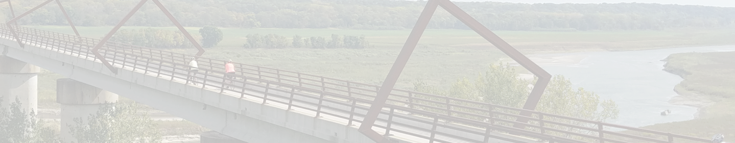
Two issues I have with the Sandel Legacy Trail is it is hard to tell which parts of the trail linking Galena and Sunbury are [1] There are THREE TRAIL NAMES associated with this trail. Riding southwest to northeast, you pick up the Galena Brick Trail in Galena, either from Dustin Rd which is county road 104 or from N. Walnut Street in Galena proper if you followed West Columbus Street into Galena to go to The Coffee Vault or Galena Diner or simply through central Galena. Once you catch the Eastbound{Northeast bound} Galena Brick Trail , you pass through a park and playground, Miller Park and continue eastbound through residential Galena. Follow the trail straight into Sunbury and exit and you see the sign that says Sandel Legacy Trail . But as you are riding along on this trail, some of the streetsigns labeling the trail say Thomas W Hopper legacy Trail. Thus on a short 2.5 mile trail, you see three name changes and the transitions are not clear. Sandal Legacy is only named prominently on a sign at the east trailhead. [2] The continuation of the Ohio to Erie Trail from the Sandel Legacy is not clear from the map or from wayfaring signs at the Northeast trailhead of the Sandel Legacy. The map suggests you turn to S Columbus Street to follow a path to the North through Sunbury to Rainbow Street. However doing so requires a n unmarked LEFT TURN after crossing the Bridge over S Columbus Street to leave the trail and roll down to that street. The trail continues east to where the actual Sandel Legacy Sign is posted then ends in gravel through which you cut to the north to find yourself on N Vernon Street then you have to make a LEFT TURN {No sign informing you of this} onto E Cherry Street to get to North Columbus Street which you can then take to Rainbow Avenue. Signs for Ohio bike route 1 are pretty clear once you make it onto North Columbus Street, they will guide you to Rainbow Ave to High Street and then to Hartford Rd which gets you out of Sunbury, up a little hill, then you are ready for the actual Delaware County Preservation Parks Ohio to Erie Trail, all trail as of 6/3/2022 and it takes you onto the Heart of Ohio Trail. Sandel Legacy Trail itself is pretty nice but it is confusing, poorly signed especially at its transitions into Sunbury and it is unclear where it becomes Thomas W Hopper or Galena Brick.

Not too bad for being down town Columbus. A few spots were we saw some homeless folks. But no one gave any troubles.

Not too bad for being down town Columbus. A few spots were we saw some homeless folks. But no one gave any troubles.

Trails connected

I rode this trail on March 9, 2021 after having parked at the Depot in Sunbury. The Sandel Legacy Trail started just NE of the depot, went behind the building and seamlessly connected to the Thomas W. Hopper Legacy Trail, also or previously called the Galena Brick Trail. Only because of the signs alongside the trail, did I know that I was on a different trail. Signs identify various trees are along the trail. There are also many extensions going into the subdivisions being built. It also went by the Galena Shale and Brick Factory. Once I got to the end of the trail where it met the road in Galena, I turned around, pedaled past the Depot and on some of the streets in Sunbury until I got on the Meredith State Road Trail. Then I turned around and went back to my car. The total distance on the three trails was 6 miles.

A Great Network of Trails Serving the City of Westerville

The Westerville B&W is more a network of trails rather than one single trail. They are not necessarily all rail-trails, though the Ohio to Erie Trail (OTET) in this trail system certainly seems like one because of how straight it was and how gradual the changes in elevation were. I rode just two of the trail routes in this network: The Ohio to Erie Trail (The Towers Trail on some maps) and the County Line/Schrock Trail. I rode the Ohio to Erie Trail south from Maxtown Road where the Genoa Trail ended, to County Line Road where I crossed over the street on a bridge and then circled back to pick up the County Line/Schrock Trail. I headed west on the County Line/Schrock Trail in order to get closer to the Polaris area where my hotel for the evening was located. The County Line/Schrock Trail definitely is not a rail-trail as the it rises and falls as it runs parallel to County Line Road. The ascents and descents were not too bad but they were not railroad grade hills. As I rode these trails I was struck by how wide they were, and how well they seemed to fit in with local infrastructure. Part of me thinks that one reason for the many wide trails in this network was that they were built as the city transitioned from a farm community to a Columbus suburb before many of the buildings and homes in the area were built. Or perhaps the community had a visionary City Council and Mayor that knew that these trails were something that a growing community would want to attract new residents and pushed for their construction despite the cost and barriers that had to be overcome.

The next day I rode the same trail routes out of town. I rode south on the Ohio to Erie Trail until I reached the Westerville Bike Depot. The Bike Depot was an interesting place to stop. It has a very clean and awesome display of now and then pictures of Westerville. There are water fountains, bike racks, rest rooms, lockers, a picnic table, and a fireplace. It is located behind the Westerville Public Library in Hanby Park. The southbound OTET route in Westerville is well signed and easy to follow. You follow the Ohio to Erie Trail south until you reach Schrock Road, then follow the bike lane on Schrock which leads you to the Alum Creek Trail.

I plan to come back to Westerville to check out the rest of the trails in this network.

wolf creek Reeks

Trail is poorly marked and littered in trash and glass. It looks like they’re adding new segments near the creak but most of the trail is still on city sidewalks covered in glass. Zero pride in this community. Worst trail in this area.

Section Between Rt 800 and Rt 416 Update 04/23/25

Trail still says it's closed, could the Great Trail Boy Scout trust be the reason?

Explore by City

Explore by City

Explore by Activity

Explore by Activity

Log in to your account to:

  • View trail paths on the map
  • Save trails to your account
  • Add trails, edit descriptions
  • Share photos
  • Add reviews

Log in with Google

Log in with Apple

OR

Register for free!

Join TrailLink (a non-profit) to view more than 40,000 miles of trail maps and more!

Register with Google

Register with Apple

OR

Your account has been deleted.